Category:Leigh, Greater Manchester
Jump to navigation
Jump to search
English: Leigh (pop. 43,000) is a town within the Metropolitan Borough of Wigan, in Greater Manchester, England. It is west of Manchester. Leigh is situated on low lying land to the north west of Chat Moss.
Italiano: Leigh è una cittadina di 44.122 abitanti della contea della Greater Manchester, in Inghilterra.
Nederlands: Leigh is een plaats in het bestuurlijke gebied Wigan, in het Engelse graafschap Greater Manchester. De plaats telt 43.006 inwoners.
Português: Leigh é uma cidade do Distrito Metropolitano de Wigan, na Greater Manchester, Inglaterra. Fica a 10 km sudoeste de Wigan, e 10 km oeste de Manchester.
town in Greater Manchester, UK  | |||||
| Upload media | |||||
| Instance of | |||||
|---|---|---|---|---|---|
| Location | Wigan, Greater Manchester, North West England, England | ||||
 | |||||
Subcategories
This category has the following 17 subcategories, out of 17 total.
B
D
- Kathleen Mary Drew-Baker (2 F)
H
- Higher Folds (12 F)
L
M
P
- Parsonage Colliery (5 F)
- Pennington Flash Country Park (133 F)
S
T
W
Media in category "Leigh, Greater Manchester"
The following 170 files are in this category, out of 170 total.
-
-
 A580 heads east - geograph.org.uk - 2363527.jpg 640 × 480; 55 KB
-
 A580 near Bedford Bridge - geograph.org.uk - 2983028.jpg 640 × 480; 41 KB
-
 A580 near Lately Common - geograph.org.uk - 2363557.jpg 640 × 480; 50 KB
-
 A580 south of Marsland Green - geograph.org.uk - 2364706.jpg 640 × 480; 49 KB
-
 A580 Where it crossed the dismantled railway - geograph.org.uk - 2492933.jpg 3,695 × 2,777; 3.72 MB
-
 Atherton Brook - geograph.org.uk - 2975451.jpg 640 × 480; 707 KB
-
 Atherton Hall - geograph.org.uk - 104503.jpg 640 × 480; 140 KB
-
 Back streets of Leigh - geograph.org.uk - 4857066.jpg 1,200 × 900; 600 KB
-
 Bedford Bridge on the East Lancs Road - geograph.org.uk - 2097669.jpg 1,600 × 1,198; 468 KB
-
 Bedford Brook - geograph.org.uk - 2325449.jpg 640 × 480; 318 KB
-

-

-
 Bedford Mill (geograph 2636815).jpg 4,349 × 2,894; 6.66 MB
-
 Bedford Moss - geograph.org.uk - 2317124.jpg 640 × 480; 230 KB
-
 Bee Fold Lane - geograph.org.uk - 2975445.jpg 640 × 480; 396 KB
-
 Beswick House - geograph.org.uk - 2068767.jpg 2,048 × 1,117; 1.19 MB
-
 Bradshawgate, Leigh - geograph.org.uk - 2325243.jpg 640 × 480; 209 KB
-
 Bradshawgate, Leigh - geograph.org.uk - 3646150.jpg 1,024 × 768; 520 KB
-
 Brooklands Mill, Leigh - geograph.org.uk - 748457.jpg 640 × 428; 82 KB
-
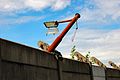
 Canal crane - geograph.org.uk - 815223.jpg 480 × 640; 73 KB
-
 Car dealership on Plank Lane - geograph.org.uk - 3355389.jpg 1,024 × 768; 95 KB
-
 Chapel, Leigh Cemetery - geograph.org.uk - 2975168.jpg 640 × 480; 477 KB
-
 Chatham House, Leigh.jpg 4,224 × 3,168; 5.63 MB
-
 Coronation Drive - geograph.org.uk - 2983901.jpg 640 × 480; 53 KB
-
 Coronation Drive - geograph.org.uk - 2983919.jpg 640 × 480; 60 KB
-
 Crankwood Road - geograph.org.uk - 2984020.jpg 640 × 480; 61 KB
-
 Crankwood Road looking west - geograph.org.uk - 2984085.jpg 640 × 480; 57 KB
-

-
 East Lancashire Road - geograph.org.uk - 55605.jpg 640 × 480; 76 KB
-
 East Lancashire Road - geograph.org.uk - 55607.jpg 640 × 480; 78 KB
-
-

-
 East Lancs Road sign for Within Carrs Nature Reserve - geograph.org.uk - 2097659.jpg 1,600 × 1,198; 372 KB
-
-
 Entering Windy Bank Wood - geograph.org.uk - 4028739.jpg 640 × 480; 414 KB
-
 Fast food restaurant, Leigh - geograph.org.uk - 3355777.jpg 1,107 × 741; 202 KB
-
 Fields near Windy Bank Farm - geograph.org.uk - 1769547.jpg 4,224 × 3,168; 3.18 MB
-
 Flickr - ronsaunders47 - A HARD DAY PLAYING GOLF..jpg 3,008 × 2,000; 2.65 MB
-
 Flickr - ronsaunders47 - Canal to oneself. 2.jpg 2,592 × 1,944; 1.05 MB
-
 Flickr - ronsaunders47 - Canal to oneself..jpg 2,592 × 1,944; 1.1 MB
-
 Flickr - ronsaunders47 - CANALSIDE SIGNPOST..jpg 3,008 × 2,000; 4.65 MB
-
 Flickr - ronsaunders47 - CANALSIDE WALK..jpg 3,008 × 2,000; 1.81 MB
-
 Flickr - ronsaunders47 - Disappearing into the distance..jpg 3,008 × 2,000; 6.55 MB
-
 Flickr - ronsaunders47 - How do you make something circular with rectangular bricks.jpg 2,000 × 3,008; 2.88 MB
-
 Flickr - ronsaunders47 - Leigh Canal. N-W England. (cropped).jpg 1,578 × 1,181; 590 KB
-
 Flickr - ronsaunders47 - Leigh Canal. N-W England..jpg 1,600 × 1,205; 611 KB
-
 Flickr - ronsaunders47 - LETTING THE WORLD GO BY.1.jpg 3,008 × 2,000; 1.35 MB
-
 Flickr - ronsaunders47 - Play area by the canalside..jpg 3,008 × 2,000; 2.41 MB
-
 Flickr - ronsaunders47 - STEPS, MORE STEPS ^ A SIGNPOST..jpg 3,008 × 2,000; 5.29 MB
-
 Flickr - ronsaunders47 - URBAN DECAY 2.LEIGH NW ENGLAND..jpg 2,804 × 1,864; 1.15 MB
-
 Flickr - ronsaunders47 - URBAN DECAY..jpg 2,804 × 1,864; 592 KB
-
 Forty years on, The rucks - geograph.org.uk - 4248389.jpg 5,184 × 3,456; 2.33 MB
-
 Green Lane looking south - geograph.org.uk - 1483972.jpg 640 × 438; 49 KB
-
 Greenfold Way on Leigh Business Park - geograph.org.uk - 2097714.jpg 1,600 × 1,198; 397 KB
-
 Ground Maintenance - geograph.org.uk - 55603.jpg 640 × 480; 65 KB
-
 Hand Lane - geograph.org.uk - 2809860.jpg 640 × 480; 556 KB
-
 Hand Lane - geograph.org.uk - 2809865.jpg 640 × 480; 543 KB
-
 Hand Lane-Carr Lane Junction - geograph.org.uk - 2809873.jpg 640 × 480; 419 KB
-
 Hawkhurst Farm - geograph.org.uk - 2748062.jpg 4,000 × 3,000; 4.07 MB
-
 Heather Frederiksen's gold postbox in Leigh, Greater Manchester.jpg 1,333 × 2,000; 1.99 MB
-
 Hindsford Brook - geograph.org.uk - 2975422.jpg 640 × 480; 460 KB
-
 Hope Carr Terrace at Hope Withins Nature Reserve - geograph.org.uk - 2097701.jpg 1,600 × 1,198; 637 KB
-
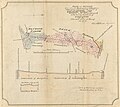 Kenyon and Leigh railway plan.jpg 1,772 × 1,574; 921 KB
-
 Lane and footpath north of footbridge 10 - geograph.org.uk - 3914107.jpg 1,600 × 1,200; 762 KB
-
 Langley Platt Bridge - geograph.org.uk - 2975418.jpg 640 × 480; 572 KB
-
 Langley Platt Lane - geograph.org.uk - 2975387.jpg 640 × 480; 528 KB
-
 Leigh - former municipal college and library (geograph 4200539).jpg 1,600 × 1,237; 547 KB
-
 Leigh Bus Station - geograph.org.uk - 2325234.jpg 640 × 480; 161 KB
-
 Leigh business park - geograph.org.uk - 2069153.jpg 2,048 × 1,536; 404 KB
-
 Leigh College.JPG 480 × 640; 74 KB
-
 Leigh Community Fire Station - geograph.org.uk - 3355794.jpg 640 × 480; 50 KB
-
 Leigh England.jpg 2,000 × 1,333; 1.77 MB
-
 Leigh fire station - geograph.org.uk - 1394729.jpg 640 × 427; 185 KB
-
 Leigh from the air - geograph.org.uk - 3948273.jpg 640 × 480; 164 KB
-
 Leigh from the air - geograph.org.uk - 3948280.jpg 640 × 480; 167 KB
-
 Leigh from the air - geograph.org.uk - 3948317 (cropped).jpg 617 × 339; 138 KB
-
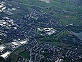 Leigh from the air - geograph.org.uk - 3948317.jpg 640 × 480; 194 KB
-
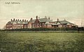 Leigh Infirmary.jpg 761 × 475; 170 KB
-
 Leigh Library by Night - geograph.org.uk - 933574.jpg 640 × 425; 100 KB
-
 Leigh Road - geograph.org.uk - 2044656.jpg 1,600 × 1,198; 361 KB
-
 Leigh Road, Leigh - geograph.org.uk - 1946672.jpg 4,224 × 3,168; 5.71 MB
-
 Leigh Spinners - No. 2 mill engine - geograph.org.uk - 5011301.jpg 640 × 427; 76 KB
-
 Leigh spinners - No. 2 mill engine - geograph.org.uk - 5011302.jpg 640 × 427; 88 KB
-
 Leigh Spinners - No. 2 steam engine - geograph.org.uk - 5010004.jpg 640 × 427; 82 KB
-
 Leigh Spinners No. 2 mill - rope race - geograph.org.uk - 5010122.jpg 409 × 640; 112 KB
-
 Leigh Sports Village - geograph.org.uk - 2199063.jpg 640 × 480; 104 KB
-

-
 Leigh Sports' Village before it existed (shortly after the diggers moved in).jpg 3,295 × 1,162; 2.76 MB
-
 Leigh, obelisk - geograph.org.uk - 1548839.jpg 480 × 640; 79 KB
-
 Leigh, Obelisk and Boar's Head - geograph.org.uk - 806241.jpg 480 × 640; 95 KB
-
 Lilford flood defences - geograph.org.uk - 4000672.jpg 640 × 480; 102 KB
-
 Lilford flood defences - geograph.org.uk - 4000675.jpg 640 × 480; 87 KB
-
 Lilford flood defences - geograph.org.uk - 4000678.jpg 640 × 480; 87 KB
-
 Long Causeway - geograph.org.uk - 2941035.jpg 640 × 481; 739 KB
-
 Long Causeway - geograph.org.uk - 2941042.jpg 481 × 640; 566 KB
-
 Long Causeway - geograph.org.uk - 2975448.jpg 640 × 480; 462 KB
-
 Long Causeway, Leigh - geograph.org.uk - 2941039.jpg 640 × 481; 772 KB
-
 Looking towards Leigh centre - geograph.org.uk - 842339.jpg 640 × 480; 73 KB
-
 Looking towards Market St - geograph.org.uk - 842323.jpg 480 × 640; 76 KB
-
 Manchester Road at Leigh boundary - geograph.org.uk - 2983878.jpg 640 × 481; 45 KB
-
 Market Place, Leigh - geograph.org.uk - 3646116.jpg 1,024 × 767; 590 KB
-
 Market Street, Leigh.jpg 1,600 × 1,225; 598 KB
-
 Mill engine - geograph.org.uk - 1772767.jpg 1,600 × 1,200; 288 KB
-
 Mill Lane, Chapel Street, Leigh - geograph.org.uk - 2197615.jpg 640 × 480; 80 KB
-
 Mills galore, Leigh 1976 - geograph.org.uk - 1766396.jpg 1,690 × 2,482; 652 KB
-
 Mills in Leigh, 1974 - geograph.org.uk - 1766215.jpg 2,320 × 1,560; 224 KB
-
 Morrisons Supermarket - Leigh - geograph.org.uk - 3006902.jpg 4,288 × 3,216; 3.37 MB
-
 New Bear Hey near Smith's Bridge - geograph.org.uk - 5142203.jpg 1,024 × 768; 204 KB
-
-
 Old Hall Farm, near Atherton Hall - geograph.org.uk - 104514.jpg 640 × 480; 106 KB
-
 Old Hall Mill Lane - geograph.org.uk - 2941044.jpg 640 × 481; 642 KB
-
 Old Hall Mill Lane, The Avenue - geograph.org.uk - 2941030.jpg 640 × 481; 529 KB
-
 Parsonage Retail Park - geograph.org.uk - 937472.jpg 640 × 453; 173 KB
-
 Parsonage Retail Park - geograph.org.uk - 937474.jpg 640 × 425; 107 KB
-

-

-
 Pennington Brook - geograph.org.uk - 52061.jpg 640 × 480; 64 KB
-
 Pennington Brook - geograph.org.uk - 55601.jpg 640 × 480; 95 KB
-
 Pennington Hall Park, Leigh - geograph.org.uk - 2557887.jpg 4,523 × 3,010; 5.72 MB
-
 Pete-shelley (cropped).jpg 2,582 × 3,053; 1.78 MB
-
 Pete-shelley.jpg 3,840 × 5,760; 3.36 MB
-
 Pickley Green from the air - geograph.org.uk - 3948297.jpg 640 × 480; 199 KB
-
 Postbox - Market St Leigh - geograph.org.uk - 933540.jpg 470 × 640; 212 KB
-

-
 Public footpath near Crank Wood - geograph.org.uk - 3737244.jpg 4,608 × 3,456; 3.08 MB
-
 Railway Embankment - geograph.org.uk - 747822.jpg 640 × 479; 47 KB
-
 Railway remnant, Queen Street, Leigh - geograph.org.uk - 5126479.jpg 1,024 × 768; 119 KB
-
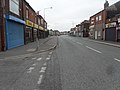
 Railway Road Leigh - geograph.org.uk - 933543.jpg 640 × 425; 162 KB
-
 Rhyl Fold Farm, Leigh - geograph.org.uk - 104510.jpg 640 × 480; 144 KB
-
 Road at Leigh, Greater Manchester - DSC09951.JPG 3,648 × 2,736; 3.62 MB
-
 Robin - geograph.org.uk - 111907.jpg 640 × 462; 212 KB
-

-
 Rugby Pitch - geograph.org.uk - 2809855.jpg 640 × 480; 509 KB
-
 Pete shelley.jpg 1,296 × 972; 152 KB
-
 Spinning Jenny Way, Leigh - geograph.org.uk - 933544.jpg 640 × 425; 141 KB
-
 St Mary's Church and Market Obelisk - geograph.org.uk - 5894955.jpg 1,280 × 1,261; 1.35 MB
-
 Stream from Bedford Bridge - geograph.org.uk - 1848409.jpg 4,224 × 3,168; 2.2 MB
-
 Sunset at Pennington Flash - geograph.org.uk - 280200.jpg 640 × 480; 79 KB
-
 Superstore, Leigh - geograph.org.uk - 3355770.jpg 640 × 480; 50 KB
-
 Terraced Row of Houses - Pickley Green - geograph.org.uk - 3737281.jpg 4,608 × 2,237; 2.01 MB
-
 The Avenue, Leigh - geograph.org.uk - 2636636.jpg 4,278 × 2,810; 6.32 MB
-
 The Avenue, Leigh - geograph.org.uk - 933550.jpg 640 × 425; 151 KB
-
 The brook at the end of Park Lane - geograph.org.uk - 2636793.jpg 3,774 × 2,965; 6.78 MB
-
 The cycle lane on the East Lancs Road - geograph.org.uk - 2003692.jpg 2,048 × 1,536; 1.84 MB
-
 The East Lancs Road - level with Leigh - geograph.org.uk - 1906914.jpg 2,048 × 1,536; 1.28 MB
-
 The footpath by the school - geograph.org.uk - 2950385.jpg 4,592 × 3,056; 7.88 MB
-
 The Parsonage Retail Park - geograph.org.uk - 2557961.jpg 4,589 × 2,484; 6.4 MB
-
 The Soul Partners - Oval Ball Club, Wilkinson St, Leigh, Lancs.jpg 1,735 × 1,179; 426 KB
-
 The Spindle - geograph.org.uk - 933580.jpg 425 × 640; 168 KB
-
 The track to Walmsley Farm - geograph.org.uk - 2950619.jpg 4,592 × 3,056; 6.79 MB
-
 The way into Leigh by canal - geograph.org.uk - 1500533.jpg 640 × 479; 101 KB
-
 Towing pole, Butts Bridge - geograph.org.uk - 1766370.jpg 1,690 × 2,482; 722 KB
-
 Traffic on the A579 Atherleigh Way - geograph.org.uk - 925208.jpg 640 × 446; 160 KB
-
 Turnpike Gallery.jpg 400 × 266; 119 KB
-
 Twist Lane - geograph.org.uk - 933552.jpg 640 × 425; 151 KB
-
 Warehouse off Lord Street, Leigh - geograph.org.uk - 80131.jpg 540 × 640; 98 KB
-
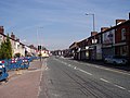
 Warrington Road (A574) - geograph.org.uk - 2324176.jpg 640 × 480; 196 KB
-
 Welch Hill Mill.JPG 2,111 × 1,555; 606 KB
-
 Wild's Passage, Leigh - geograph.org.uk - 803650.jpg 640 × 464; 76 KB
-
 Windermere Road, Leigh - geograph.org.uk - 933558.jpg 640 × 425; 156 KB
-
 Windy Bank Farm - geograph.org.uk - 58368.jpg 640 × 480; 104 KB
-
 Woodland bridleway - geograph.org.uk - 438571.jpg 640 × 480; 144 KB
-
 Alder Mill - geograph.org.uk - 1500536.jpg 476 × 640; 99 KB
-
 Dew pond in the Nature Reserve - geograph.org.uk - 309865.jpg 640 × 480; 138 KB
-
 Zetor Forterra 9641 tractor, Atherton Old Hall Farm 1.jpg 3,953 × 2,826; 9.1 MB
-
 Zetor Forterra 9641 tractor, Atherton Old Hall Farm 2.jpg 3,798 × 2,070; 7.5 MB
-
 Zetor Forterra 9641 tractor, Atherton Old Hall Farm 3.jpg 3,552 × 2,562; 8.16 MB
-
 Glaze Brook - geograph.org.uk - 52092.jpg 640 × 480; 74 KB
-
 Grazing land - geograph.org.uk - 438576.jpg 640 × 480; 129 KB


.jpg)


,_Lately_Common_-_geograph.org.uk_-_2076369.jpg)


_-_geograph.org.uk_-_3355769.jpg)


.jpg)


.jpg)


.jpg)


.jpg)


.jpg)


_-_geograph.org.uk_-_2324176.jpg)


.jpg)